AGC-VLN Lets a Drone Draw the Map a Ground Robot Actually Drives
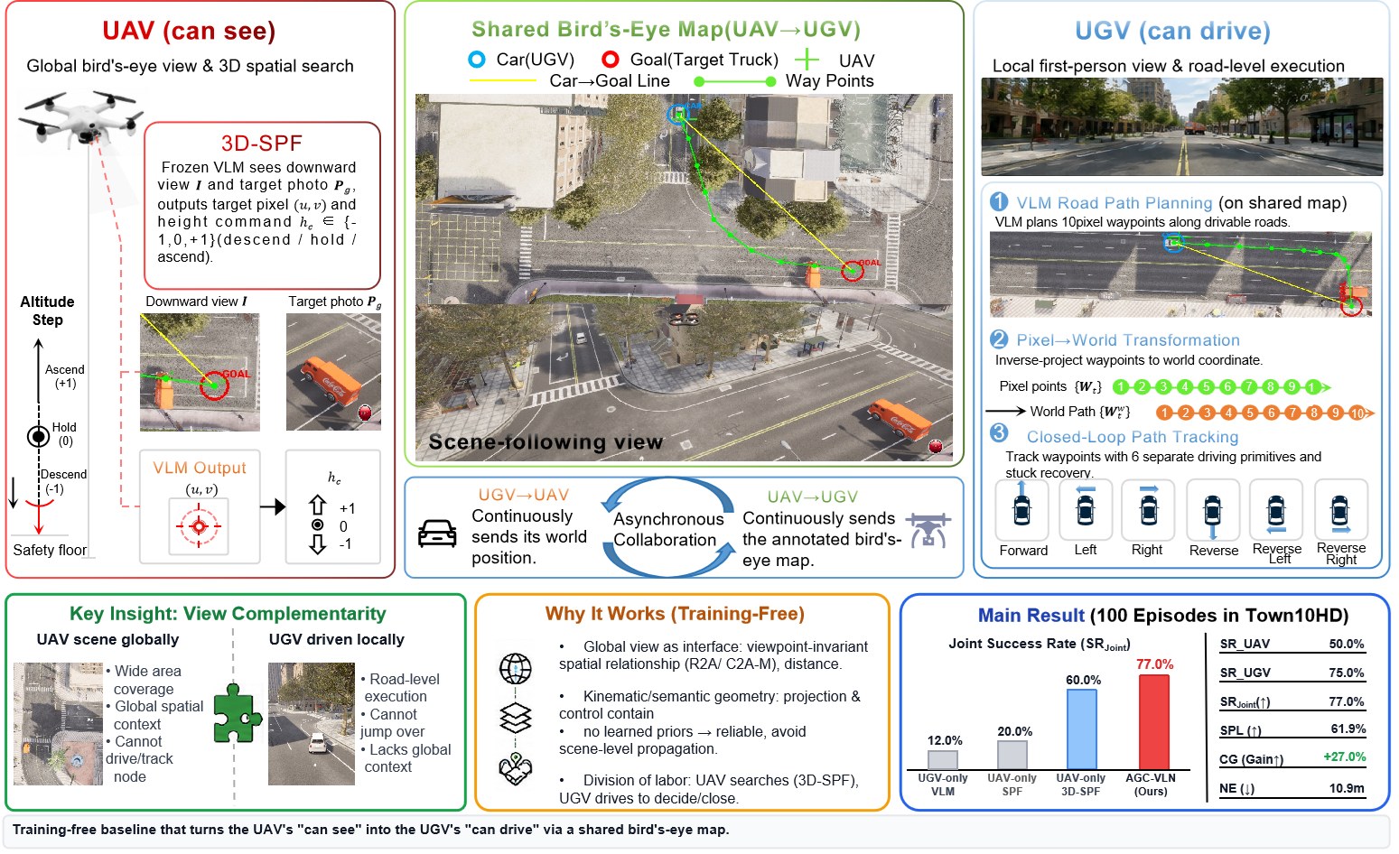
HKUST (Guangzhou) and Nanjing University of Posts and Telecommunications posted AGC-VLN on 3 September (arXiv:2609.03483): a training-free air–ground navigation stack where a UAV paints a bird’s-eye map and a UGV drives on it. No new weights. Frozen VLMs plus geometry.
A prior CARLA-Air study had already shown that five aerial VLA models do not cooperate. Text hints from the ground robot hurt. Bidirectional velocity coupling made it worse. AGC-VLN’s bet is that the interface should be a picture, not a chat.
Shared map, two jobs
The UAV looks straight down. A frozen VLM marks the target truck in that image and also emits a height command: descend, hold, or ascend. That upgrade is 3D-SPF, See-Point-Fly with a vertical search step of 10 m. The UAV then stamps the map with a blue CAR (UGV pose), a red GOAL, distance labels, and a reference line.
The UGV never has to invent a city from a bumper camera. It asks a VLM for 10 road waypoints on that annotated image, inverse-projects them with the UAV’s pose, and tracks them with six driving primitives plus a reverse-escape if it stalls.
Success is either agent inside 5 m of the target within 180 s. Both sides run gemini-3.7-flash at temperature 0.1, about one decision every 3 s.
100 episodes, then a real floor
On 100 closed-loop runs in CARLA-Air’s Town10HD (50 spawn points, two each):
- Joint success 77.0%
- UGV 75.0%, UAV 50.0%
- Collaboration gain +27.0 points over the weaker agent
- 24.0 points above Travel UAV (53.0%), the strongest published single-agent baseline they cite
- SPL 62.0%, navigation error 10.9 m
UAV-only SPF on this air-ground search sits at 20.0%. 3D-SPF alone is 60.0%. UGV-only VLM is 12.0%. The map is what moves the car: GOAL-only annotation gets 60% UGV success; adding the CAR marker lifts that to 70%, and the full overlay reaches 75%.
Altitude matters. 60 m is the sweet spot. At 30 m the field of view collapses (joint 28%). At 90–120 m the UAV’s success is 0%; the UGV still carries the joint rate.
Of 23 joint failures, 61% are undrivable VLM paths (buildings, trees, map edge). 22% die on the last meters. 17% are UAV localization, including one mis-anchor onto the wrong truck.
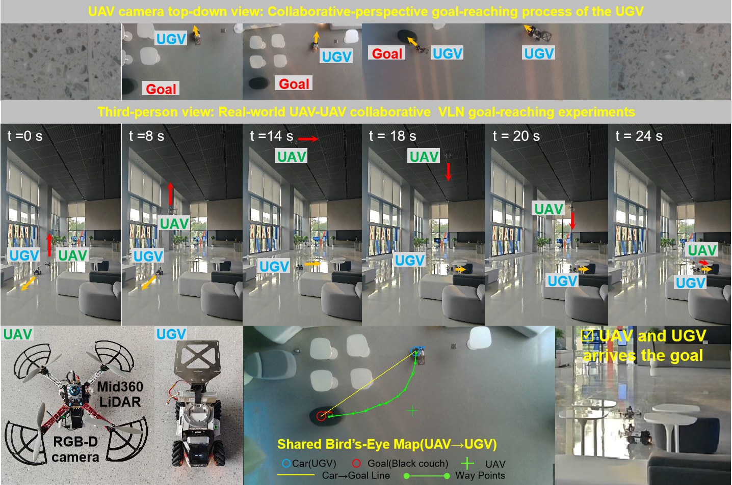
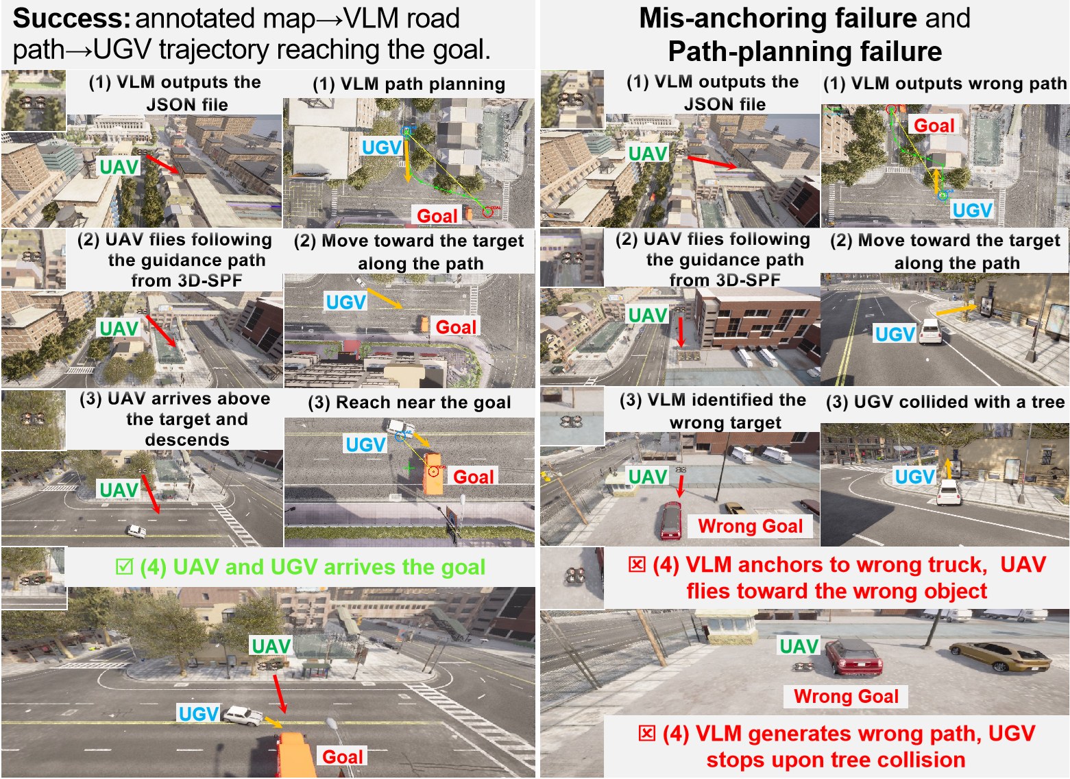
They also ran one real-robot case in a lobby. The stages match the sim. The UAV pose comes from LiDAR odometry instead of CARLA-Air’s synchronized stream.
A Human’s Take
I have watched too many “multi-agent VLA” papers glue two policies together and then act surprised when the errors multiply. Drawing CAR and GOAL on the overhead frame is almost rude in its simplicity, and it is why the collaboration gain is positive. Path planning is still the leak: 61% of the joint misses are a VLM that cannot stay on the road. Fix that, and this baseline is a tool, not just a CARLA score.